
Custom Search
|
|

|
||
 TEL:
Jan 23,95 13:34 No.005 P.30
Channel Condition Measurement
The Environmental Monitoring and Operator Guidance System {EMOGS) incorporates analysis
capabilities of the CVCGS. However, instead of using predicted information from Fleet Numerical and the
navigator, EMOGS uses real time wave and tide data from sensors installed in the channel. Because this is a far
more accurate prediction of waves and variable water levels, substantial risk reductions are realized. The following
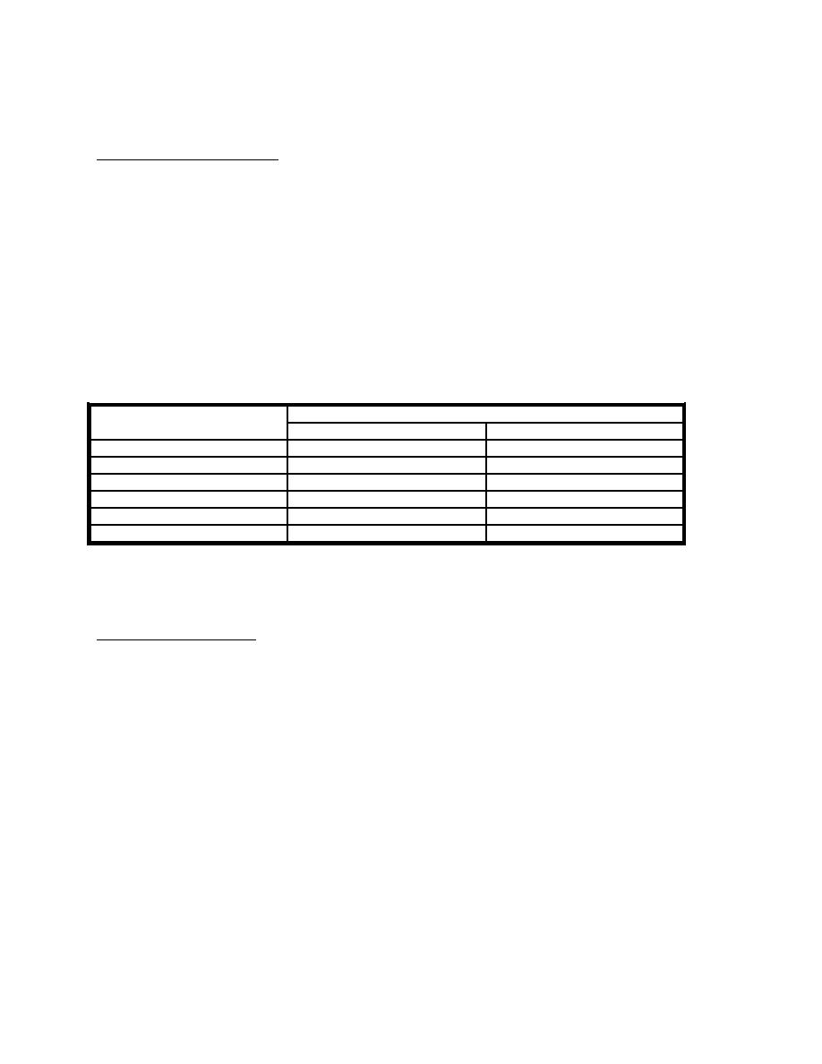
table shows the accessibility levels of CVCGS and EMOGS associated with different dredge depths for San Diego
and Mayport. An EMOGS type system is successfully being used by SUBLANT at Kings Bay, Georgia for SSBN
726 Class transits. EMOGS is recommended for channels not dredged for unrestricted operations and are subject
to wave action, particularly swells. EMOGS is a facilities improvement cost tradeoff with dredging.
OUTER CHANNEL ACCESSIBILITY
FOR A RISK OF EXCEEDING DREDGE DEPTH 1 IN 100 TIMES
CHANNEL DEPTH (feet)
DAYS PER YEAR
CVCGS
EMOGS
SAN DIEGO:
55
227
333
59
295
355
MAYPORT:
47
254
262
50
362
363
Without guidance of any sort in avoiding extreme wave conditions, risk may increase to 1 in 2.
Draft and Attitude Indication
Currently, the CVN 68 Class only has one Remote Draft Indicator and list and trim inclinometers. The
Profile Draft Indicator has been removed because it contained about a pint of mercury. Consequently, the ship does
not have the ability to accurately determine the ship's draft, list, and trim. Installation of two more Remote Draft
Indicators would provide the ability to triangulate accurate draft, list, and trim values. Based on simple geometry,
the ship could then accurately determine the extreme draft point. A JCF and ECPs are being prepared to add two
Remote Draft Indicators.
Enclosure (3)
Page 2 of 3
38
|
 |
|
 |
||